


Use the
Planning a Trip to Japan?
Share your travel photos with us by hashtagging your images with #visitjapanjp
HOME > Japan’s Local Treasures > Shimokita Peninsula and “Buddha’s Cove”
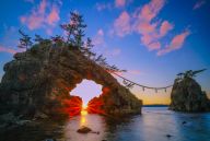
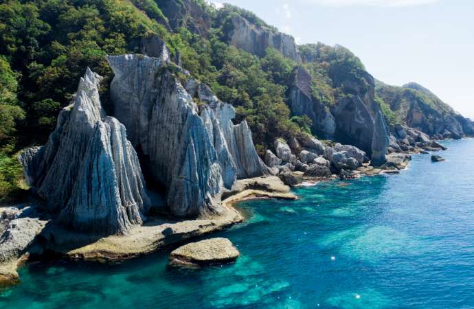
The Hotokegaura rock formations were created by 20 million years of natural erosion
Aomori Prefecture
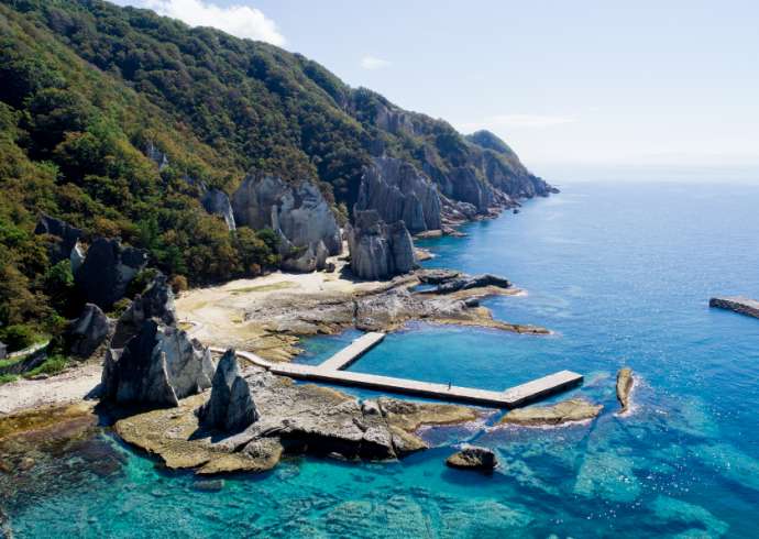
Towering at 90 meters tall, Hotokegaura is a group of green-blue and white rock formations that stretch across two kilometers of the west coast of the Shimokita Peninsula at the very top of Japan’s main island of Honshu.
Once a volcanic tuff cliff deposited nearly 20 million years ago, the giant monuments were eroded into unusual shapes by harsh weather and the rough waters of the Tsugaru Strait. Despite this, Hotokegaura takes its name from a peaceful inspiration. In English, it means “Buddha’s Cove,” and many of its formations have been named after figures and aspects of Buddhism.
Though a designated Place of Scenic Beauty and National Monument, Hotokegaura is not easily accessible. Sightseeing boats from nearby Sai Village can take you all the way to the coast on which the rock formations stand. If arriving by car, the hike from the nearest parking lot is a challenge and only recommended for experienced hikers.
How to get there
From Narita Airport, fly to Aomori Airport (about 1 hour 20 minutes) and then take the bus to Aomori Station (about 40 minutes). From Aomori Station, take the train to Noheji Station (about 45 minutes), transfer and take the train to Shimokita Station (about 1 hour), then take the bus to Sai Port (about 1 hour 30 minutes). From Sai Port, Hotokegaura is about 30 minutes by boat.
Chogo, Sai-mura, Shimokita-gun, Aomori-ken