


Don't Miss
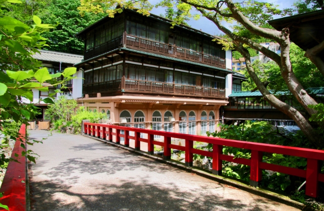
- Ryokan inns located amid mountains and numerous hot springs
- Tsugaike Nature Park's delicate alpine plants
- Guided tours around Goshikigahara Forest
- A variety of mountain trails suitable for novices and experts alike
Chubusangaku National Park is home to Japan’s Northern Alps and will reward you with dramatic alpine landscapes and pristine nature trails. Venture up soaring summits to watch the sunrise, walk between massive snow corridors or visit crystalline waterfalls amid birch and beech forests. In winter, grab your skis or snowboard and slalom down mountains up to 3,000 meters tall. Extensive hiking trails and an array of recreational activities make Chubusangaku National Park the perfect place for an alpine adventure.
Chubusangaku National Park roughly encircles Japan’s Northern Alps, which boast 10 peaks taller than 3,000 meters (Japan has 21 such mountains). The Ushiro-Tateyama mountain range and Tateyama mountain range dominate the northern section of the park. At the park's southernmost reach are Norikura Highland and Mount Norikura (3,026 m). The area is noted for its hot springs, nature trails and waterfalls.
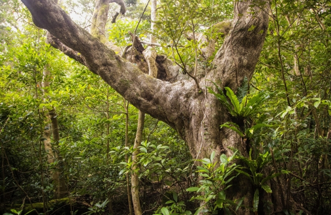
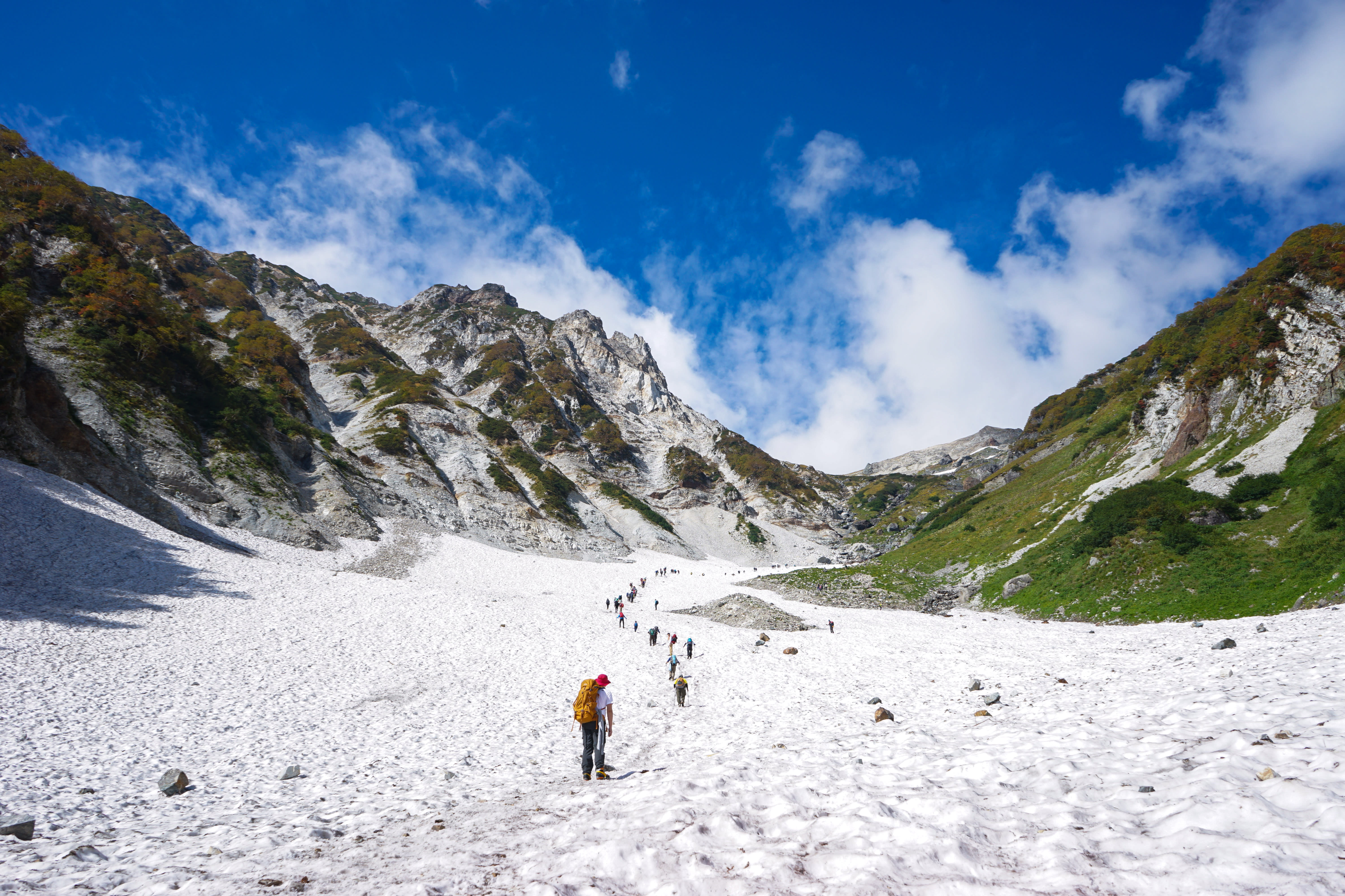
Packed with glacial valleys, lava plateaus and riverside forests, this expansive park spans parts of Gifu, Nagano and Toyama prefectures. You can reach trailheads in Kamikochi, Happo and Murodo via public transport and all three areas are particularly stunning in autumn. Because of the high altitude, snow blankets many parts of the region until the early summer months. In some places, such as the Daisekkei Valley near Mount Shirouma (Mount Hakuba), snow lies year-round.
The Tateyama Kurobe Alpine Route stretches 90 kilometers and links two prefectures, Toyama and Nagano. This route takes you on a combination of cable cars, electric buses and hiking trails. With a total elevation change of 2,400 meters, you’ll see dynamic variations in the scenery during your journey.
The Bijodaira area, situated on the Toyama side, is a serene, primeval forest of beech and cedar trees, some over 1,000 years old. Going higher, you’ll find an observation deck with lofty views of the 350-meter-tall Shomyo Falls, the highest waterfall in Japan.
Many visitors opt to take a bus straight to Murodo, the highest point of the route. At an altitude of 2,450 meters, Murodo offers fantastic views of the Tateyama mountain range and is packed with hiking trails suitable for all skill levels. Trek up to surrounding peaks such as Mount Oyama and Mount Onanji, or stroll around Mikurigaike, a cobalt-blue crater lake.

From April to mid-June, the road between Bijodaira and Murodo runs through a 20-meter-high snow corridor. A section of the snow corridor, just a short walk from Murodo Station, is open to pedestrians.
The Midagahara Wetlands—marshland covered with delicate alpine plants—sits between Bijodaira and Murodo. Here you might hear the cries of a rock ptarmigan: a bird that survived the Ice Age and which changes plumage from white in winter to brown in spring and summer.
The Hakuba region in the northern part of Chubusangaku National Park has legions of fans among winter sports enthusiasts. You can choose from a wide range of activities in this area in the summer months, including fishing, canyoning, mountain biking, and hot-air ballooning.
Tsugaike Nature Park is located near 2,932-meter Mount Shirouma, the highest peak in the Hakuba area. This pristine nature preserve has a diverse range of flora and fauna, such as Japanese wood poppies and peacock butterflies. You can reach the park by cable car, and elevated wooden promenades make it easy to explore the area. Thrill-seekers can try their hand at tandem paragliding over the park.
Another popular excursion is the walk along Happo-one Nature Trail, where you can find daylilies and a variety of alpine butterflies. Reach the trail via cable car, which extends from Mount Kurobishi to Happoike Pond. Reflections of the Hakuba mountain range on the mirror-like pond create a breathtaking spectacle.
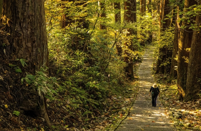
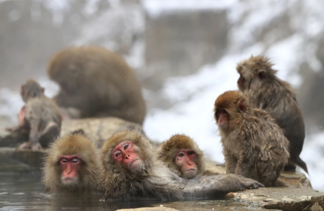
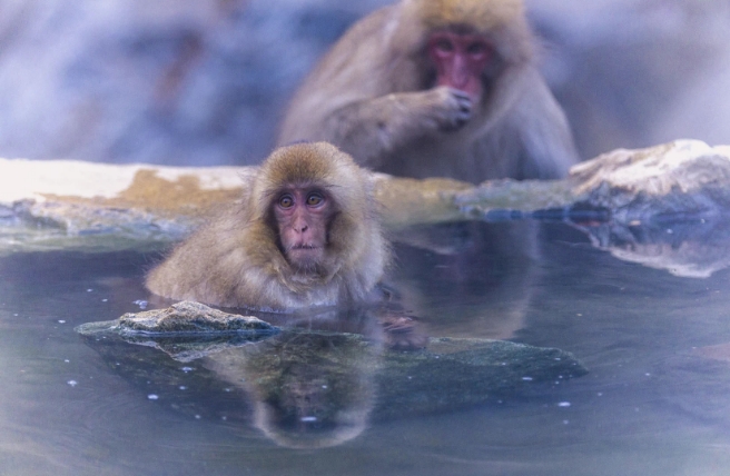
Kamikochi is a gateway to the Northern Japanese Alps, located in a deep valley along the Azusa River. The Azusa River inspired a novel by Ryunosuke Akutagawa (1892–1927) about small, mythical water spirits known as "kappa." Near Kappabashi Bridge, named after these mythical creatures, you can find a few hotels, restaurants and shops selling such delicacies as pickled coleseed greens and wasabi miso. Kamikochi offers a range of hiking trails for beginners and seasoned mountaineers alike. Take a leisurely stroll along the riverbank and explore the ponds and marshes in the area. Stop by serene Myojinike Pond or copper-hued Tashiroike Pond, which gets its distinctive color from iron deposits. Day hikers can wander up to Mount Yakedake, an active volcano, or Mount Chogatake. If you’re lucky, you might even spot a family of Japanese macaques along the way.
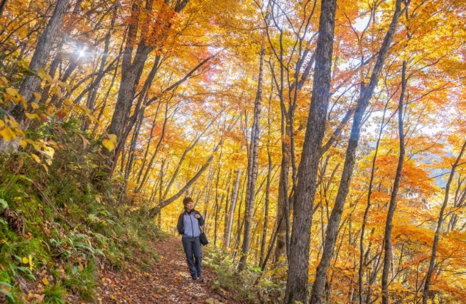
For a challenging excursion, try a multiday trek to 3,190-meter Mount Oku-Hotakadake, Japan’s third-tallest mountain, or the spear-shaped summit of Mount Yarigatake. Between these two mountains sits the Daikiretto knife-edge ridge, considered the most technically challenging route in Japan that does not require special climbing equipment. Hikers looking for a less intimidating multiday trek from Kamikochi can head to Karasawa Cirque, a glacial valley famed for its brilliant fall colors. Note that all trails close from mid-November to late April.
Another route to a high vantage point is the Shin-Hotaka Ropeway, which runs up to the observation deck on Mount Nishihotakadake and offers panoramic views of the Kamikochi area.

Reward yourself after a long day of hiking with a leisurely soak in one of the park’s mineral-rich hot springs. Your options include a stay at a traditional ryokan inn in Hirayu Onsen, Nakanoyu Onsen, Sawando Onsen or the milky-white hot springs of Shirahone Onsen.
Mount Norikura caps the southern end of Chubusangaku National Park and offers numerous hiking trails. The mountain’s highest point, Mount Kengamine, reaches an altitude of 3,026 meters, but you can take a bus to get close to the top. In the summer season, visitors flock to the summit to watch the sunrise.
At the base of Mount Norikura is a highland area known as Norikura Kogen. This scenic location is packed with nature trails, waterfalls, hot springs and recreational activities. Sanbondaki, a trio of stunning side-by-side waterfalls, is a major attraction.
You can also opt for an eight-hour guided nature tour around the Goshikigahara Forest. Goshikigahara Forest—literally, “forest of five colors”—covers 3,000 hectares and is a treasure trove of wetlands, flowers, ponds and birds. Discover the many waterfalls of the area, including the majestic Yokote Falls, and keep your eyes open for chestnut tiger butterflies and wildflowers like the Oyama magnolia (Magnolia sieboldii).

Chubusangaku National Park has a host of shrines dedicated to mountain deities, and many mountains in the area were worshipped as sacred. Mount Tateyama was a particularly popular pilgrimage site until the early 20th century. Pilgrims believed that the hot springs at the foot of the mountain were the gateway to the underworld, and a trek to the summit simulated a journey from hell to heaven.
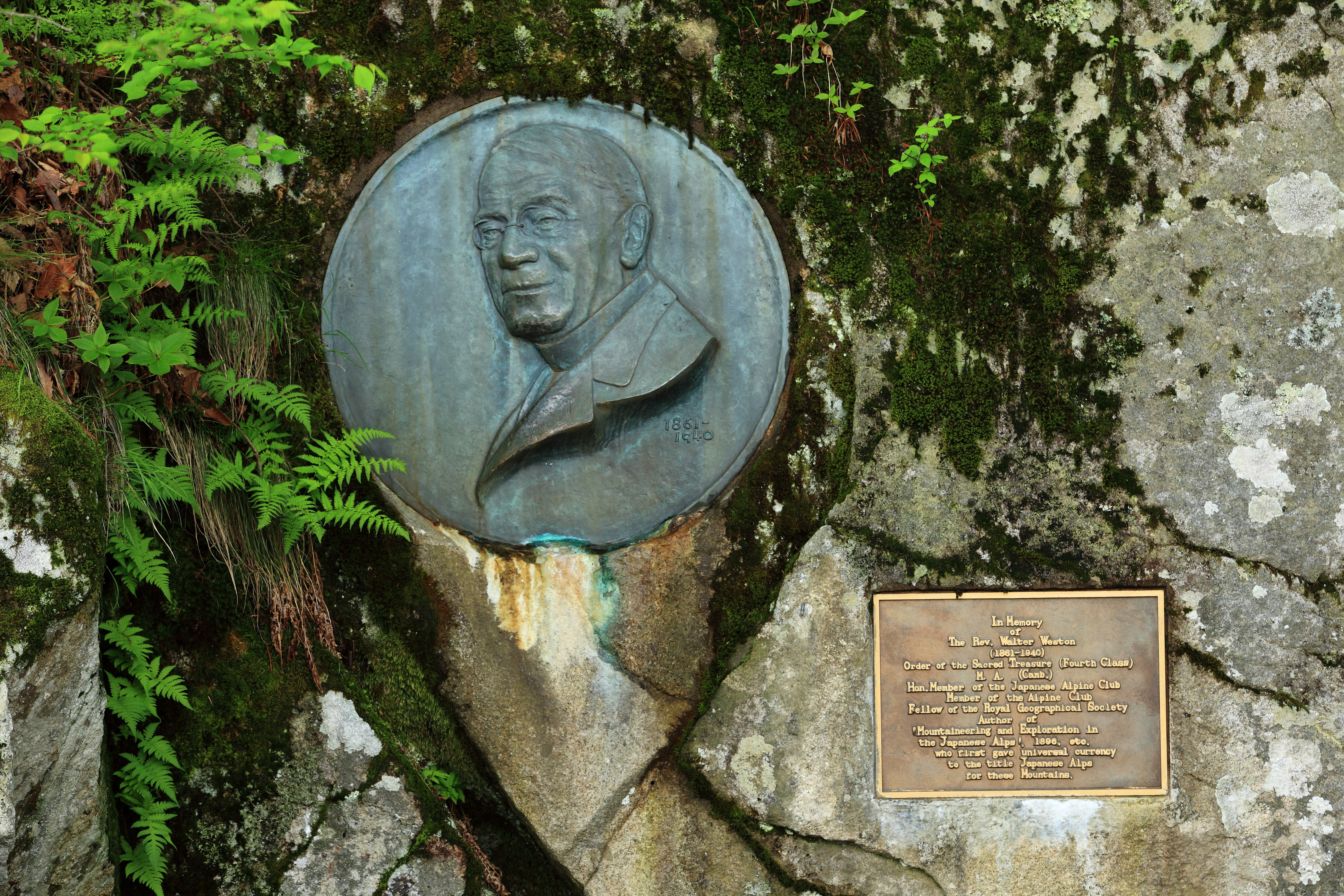
English missionary Walter Weston (1860–1940) first came to Japan in 1888 and helped raise the profile of Chubusangaku National Park’s mountains (earlier nicknamed the "Japanese Alps" by English archeologist William Gowland). Weston also played a major role in popularizing the area, and a monument dedicated to him stands in Kamikochi today. For this reason, Chubusangaku is considered by many to be the birthplace of the Japanese Alps.
Learn more about Chubusangaku National Park, the birthplace of the Japanese Alps, at the park's website.
