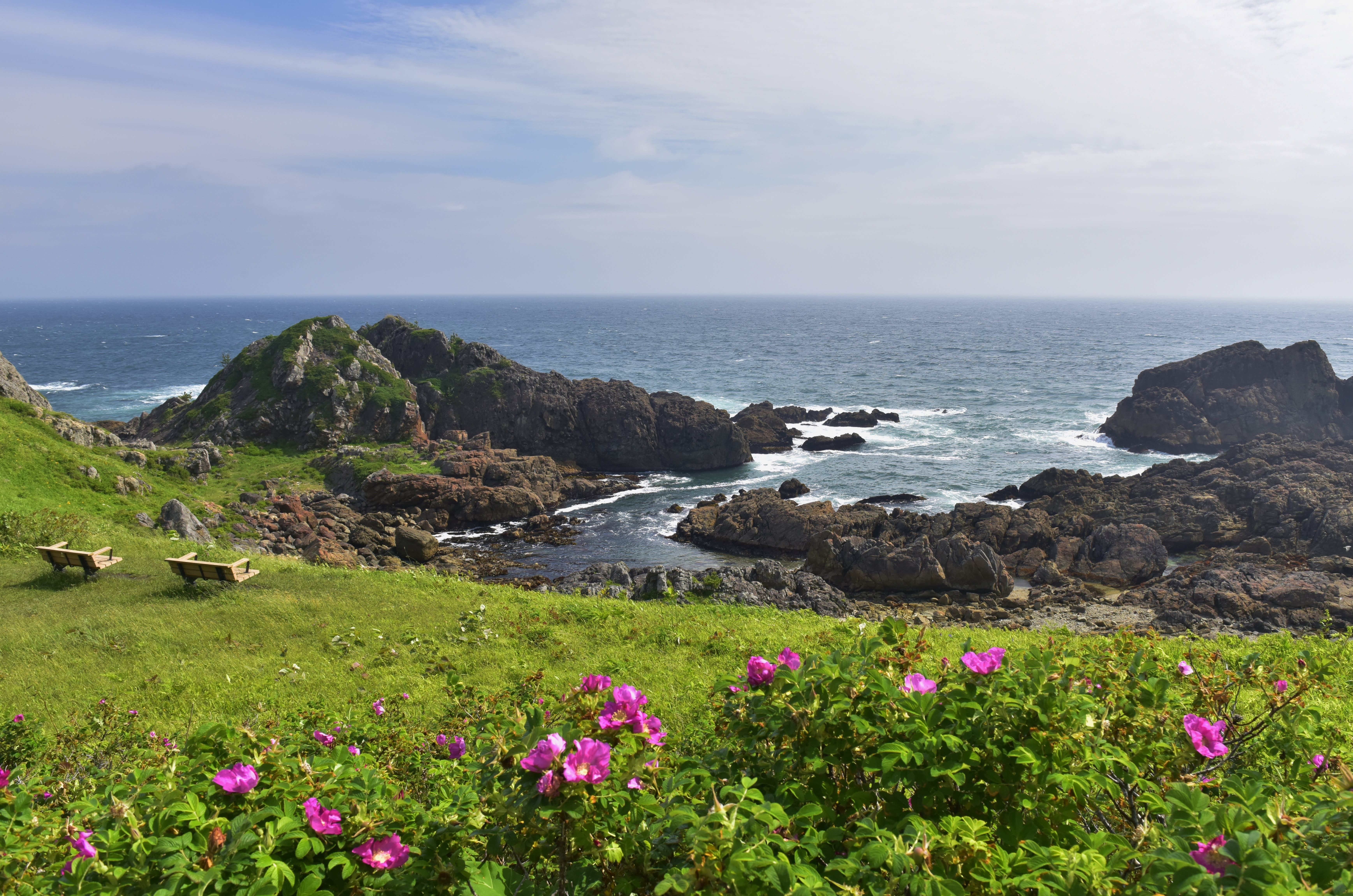
This peaceful spot on the Tanesashi Coast, just outside the city of Hachinohe on Honshu’s far northeastern coast, was one of the most northerly places hit in the March 11, 2011 disaster. A tsunami struck the coast following Japan’s most powerful earthquake on record, at a magnitude of 9.0–9.1. Waves rose as high as 40 meters, crashing inland at terrifying speeds. Over 15,000 people died, and hundreds of thousands more were left homeless.
Years later, reconstruction is ongoing, but healing after a disaster of this magnitude isn’t only about new buildings and sea defenses. In 2013, the Sanriku Fukko (reconstruction) National Park was created along this stretch of coastline, with the aim of conserving the natural environment and teaching visitors about traditional ways of balancing the bounty and danger of nature.
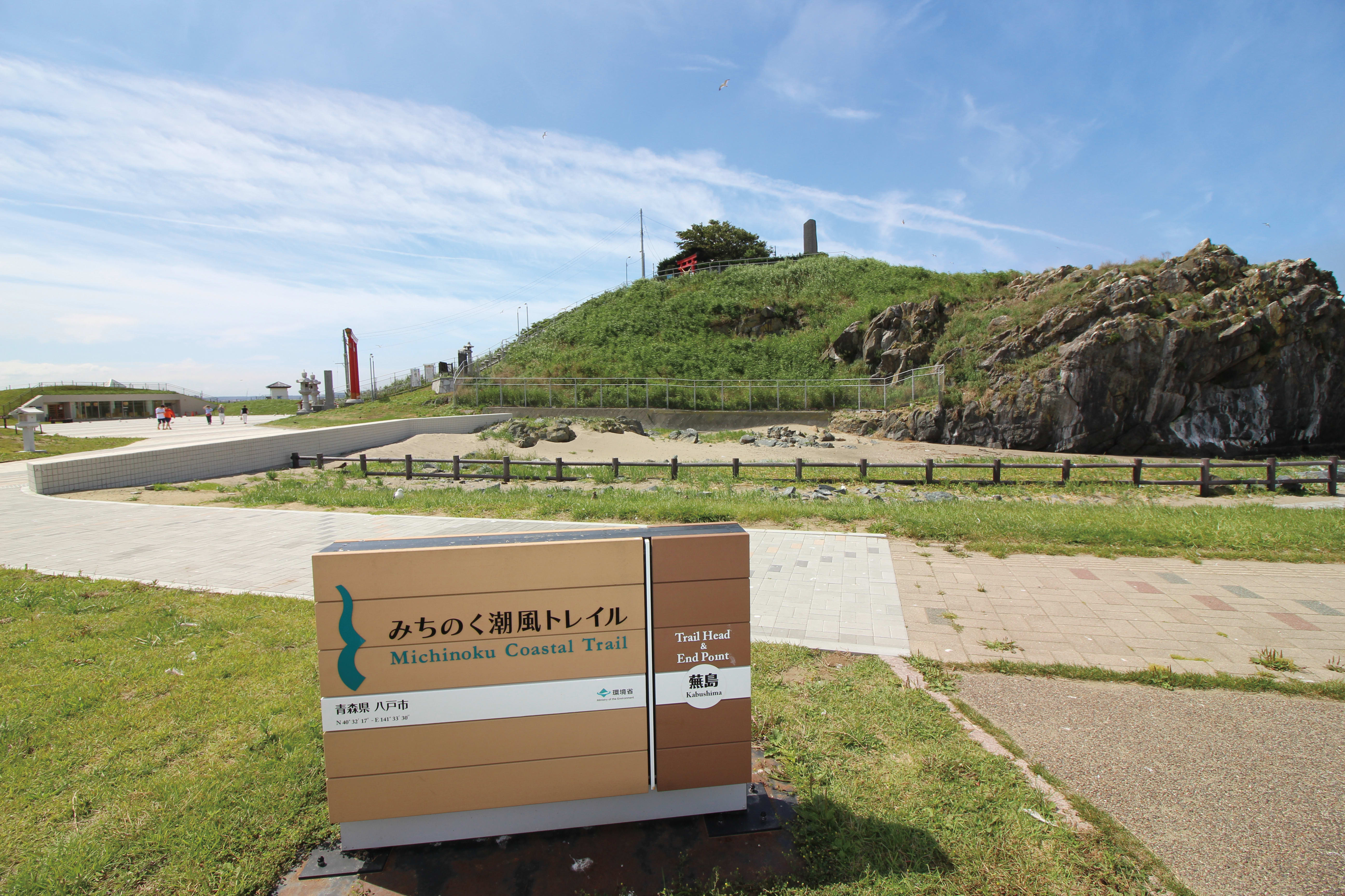
Sections of the Michinoku Coastal Trail opened at the same time, and by June 2019 the entire route was officially opened, extending through four prefectures and aiming to encourage slow and sustainable travel through the region.

Mount Hashikami
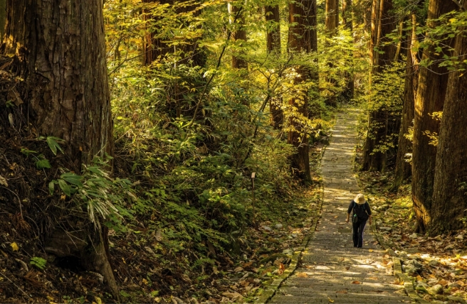
The route is divided into 28 sections with varying levels of difficulty, all of which take between one to three days to complete. It takes weeks to walk the entire path. The northernmost part of the path, the Hachinohe Section along the Tanesashi Coast, is one of the shortest routes, covering 16.5 kilometers in one day. The second part of the trail, the Hashikami Section, covers almost 34 kilometers over two days, including a climb to the summit of Mount Hashikami. All sections of the trail are connected via walking paths, but if you are short on time and energy, buses link some parts of the trail, like the Kamaishi Section, which covers 40.9 kilometers over three days of walking.

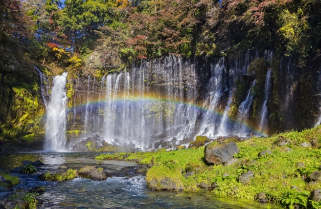
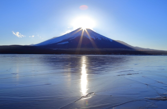
Tanesashi Coast
Trail centers staffed with knowledgeable, enthusiastic locals act as gateways to each shorter section. These visitor centers are well stocked with brochures, and make a natural meeting place for travelers. The sleek Natori Trail Center provides easy access to the Shiogama–Tago–Sendai section of the walking route and is just 20 minutes from Sendai Airport by car or taxi. This center is the headquarters of the Michinoku Coastal Trail and provides information on everything you need to know about walking the trail, including long trail walks and trail culture. At the northernmost end of the trail is the modern Tanesashi Coast Information Center.

Natori Trail Center
As Machida leads us from the visitor center to the harbor, we stroll past the glassy water. We spot starfish, sea urchins, and even a curious, snail-shaped blue blob that none of us can name. Machida calls over one of the local fishermen, Eijiro Tate, who identifies it as a very large sea hare.
We settle down for a delicious lunch of raw, creamy sea urchin and charcoal-grilled mackerel, and fall into conversation with Tate, who tells us about his experience of the 2011 disaster. He looks shyly down at his feet as he talks, and his broad face often breaks into a smile when he touches on something serious.
“My boat was lost. All the fishing boats were lost,” he tells us with a nervous laugh, shuffling his feet. “And there were no fish for a while after, either. But we had other work to do then anyway: rebuilding.”
The local fishermen were able to buy new boats and build new fishing huts with government support after about a year. But debris on the seabed had a dramatic effect on the catch, which to this day is lower than it was before the tsunami.
When I say that it must have been painful for Tate to lose his boat, his nervousness evaporates. He waves his hand in front of his face in the usual Japanese gesture of polite denial. “I think I’ve been very lucky. I’m back to fishing now, and the disaster wasn’t so bad here in Hachinohe. It was much worse to the south. I feel very grateful to live here.”
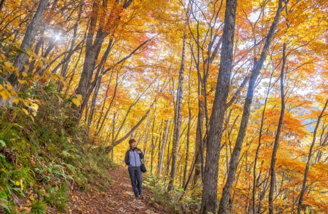
Walking along the trail, it’s easy to see why he feels lucky; it’s breathtakingly beautiful here. We cross the open grassy area to walk through coastal forests, past dramatic rock formations jutting out into the ocean and small, scenic harbors of huddled fishing boats. Machida points out a huge cherry tree growing from a rock, its leaves luxuriating in the afternoon sun.
“There’s a railway track which runs right past here,” she says, gesturing to one side. “In the spring, there are special blossom-spotting trains.” She grins wide, staring up at the tree. “But the locals know that the trail gets much closer to the trees. You can sit in the falling petals, enjoying the scent of the flowers, without paying anything.”
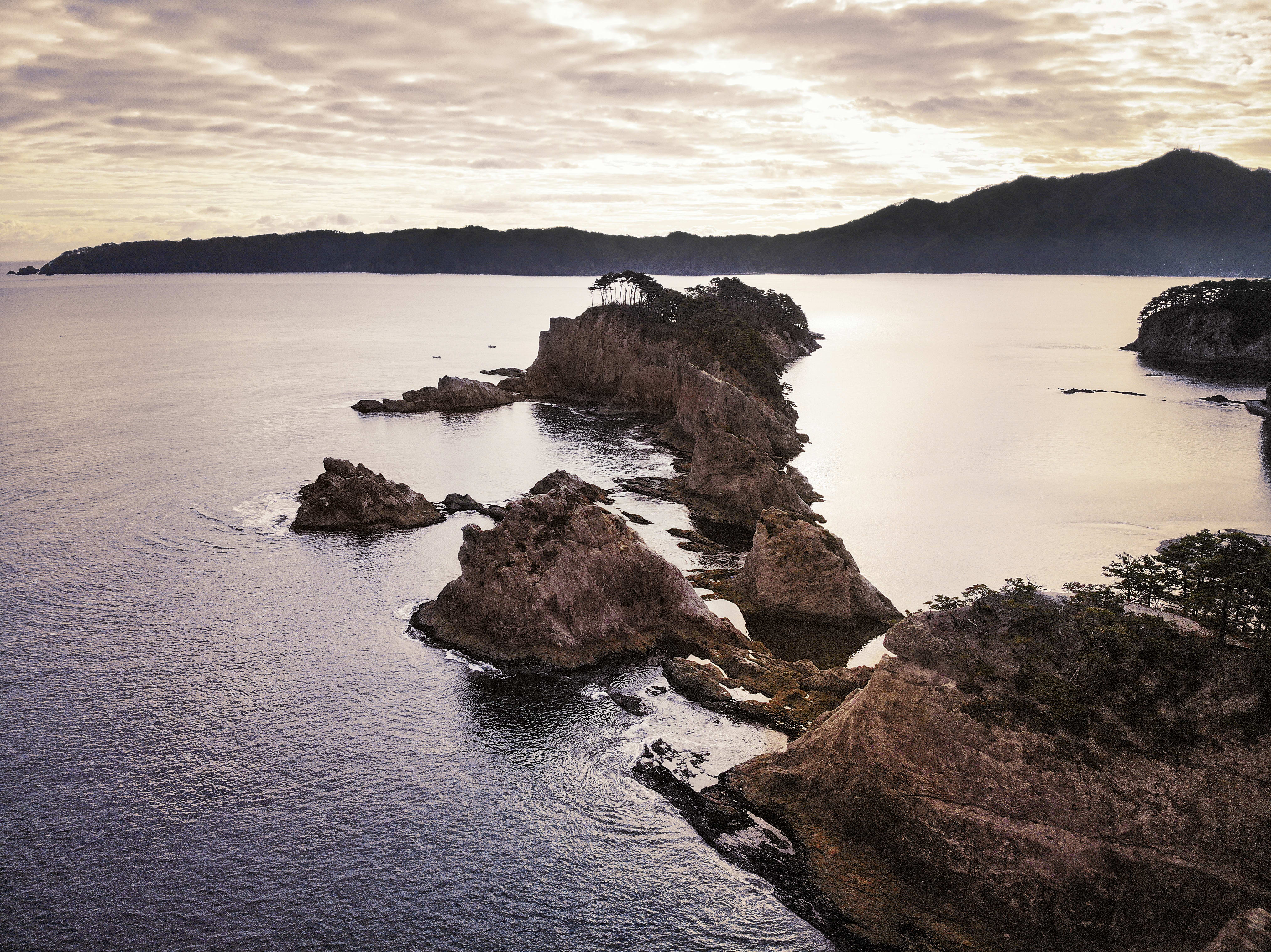
Next, we make our way south to the North Kesennuma Section, passing the jagged Kitayamazaki Cliffs and the expanse of fine, powdery sand at Jodogahama Beach, until we come to Kesennuma, a small city in Miyagi Prefecture. Fishermen are unloading their catch from gleaming boats, ferrying it over to the new buildings clustered close to the shore. There are no old trees or old buildings here; empty lots dot the townscape, and construction vehicles seem to be trundling down every other street. It’s clear now what Tate meant: the tsunami had been much more destructive further south.
Jodogahama
Our guide for the North Kesennuma Section, Nishant Annu, fills us in on the town’s recovery as we stroll around the port, interrupting himself frequently to greet people passing by. He works for the Kesennuma Tourism and Convention Bureau now, but first came to Kesennuma in 2014 as an English teacher. Though this laid-back American guy with a taste for baseball caps, skateboarding, and surfing may not seem like an obvious fit for a Japanese fishing port, he quickly found his place in this welcoming, slow-paced city.
“My apartment was down by the harbor, right next to the Recovery Village, a kind of temporary site for local businesses which no longer had premises. I didn’t speak much Japanese, so I went there every night for dinner, practicing with the locals.” He waves to a passing fisherman before continuing. “The sense of community was so strong, and that’s really why I wanted to stay. Even when the city was in ruins, it had this special feeling about it because of the people.”

Kitayamazaki
Kesennuma really was in ruins following the earthquake and tsunami. Oil spills from overturned tankers ignited, sending devastating fires ripping through the city. Over 1,000 people were killed, and thousands more were left with nowhere to go.
“Tourism is vital to recovery at this stage,” Annu tells us. “The local community has worked hard to rebuild the fishing industry, but tourism has always been important here, too. Things like the Michinoku Trail make it easier for travelers to come and experience local life for themselves, and see what’s so special about Tohoku.”

Mount Kogame
We follow the trail south out of the city center, and make a short detour inland to the hilltop temple of Seiryo-in. After a zazen meditation class, we sit and speak to the head abbot and his two sons, who are also monks. The temple is a community hub—they’ve even built a karaoke room on its grounds—and after the disaster, the monks opened it up as a shelter.
“We decided not to hold Buddhist ceremonies during that time. There were people of different religions here, and the highest priority was making them feel safe and comfortable,” the abbot, a tall, well-built man with the traditional shaved head of a monk, tells us. He pours us strong coffee (“If you visited later in the day, I’d give you beer,” he chuckles) and regales us with stories and sumo songs in his sonorous voice.
“We can’t be separate, acting like we’re holy men who are more important than everyone else,” he says firmly. “We’re part of this community just like anyone else, and that’s the most important thing.”
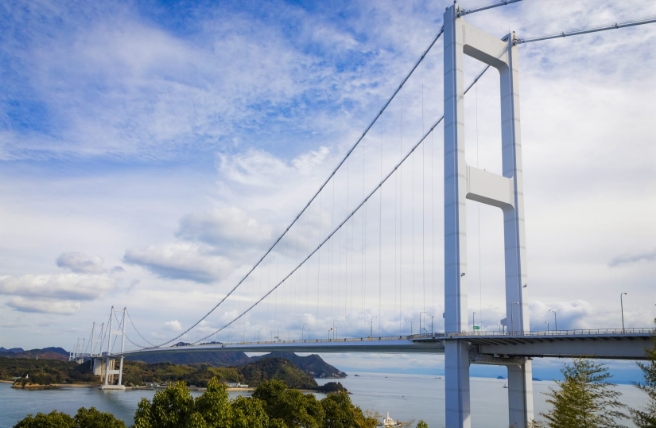
Back on the trail, our spirits lifted by the mix of peaceful contemplation and earthy humor we’d enjoyed at Seiryo-in, we wind our way back along the coastline to Oshima Island, a densely forested island in the bay connected to the mainland by a brand new bridge. Before the bridge opened in April 2019, Annu tells us, it used to only be accessible by boat.
“In the disaster, the island was cut off from all the lifelines on the mainland,” he explains. “They had to airlift supplies in, so there was a huge time lag in supporting the people who lived there.” Now, buses and bikes head over the bridge, families relax on the sandy beaches, and walkers on the Michinoku Trail make their way up to observation points, looking out over oyster-farming rafts bobbing gently on the water.
Tanesashi Coast
We make our way to a mooring where we board the boat of fourth-generation oyster farmer Komatsu Takeshi, a thoughtful-looking man with glasses and close-cropped hair. His family is one of three families practicing aquaculture, cultivating fish and shellfish in the waters around Oshima Island.
“I feel so grateful that my ancestors happened to choose this place for their work,” he tells us. “And I love my job—it’s so interesting!”
He hadn’t originally planned to join the family business. Instead, he went to the Kanto region for university and worked at an office job in Tokyo throughout his twenties. Eventually he found that job unfulfilling, though, and decided to come home with his family to Kesennuma. They enjoyed their new lifestyle, living close to the land and sea, but Komatsu was unsure of how to continue in the wake of the devastation in 2011.
“It was a year before I could even bring myself to think about starting production again. Then, it took another two years to prepare the equipment and reach the necessary environmental conditions. I asked myself, ‘Am I able to make food I want to feed my kids? Do I feel confident and safe enough for that?’ It’s only then that I started production again.”
Out on the water, Komatsu begins reeling in ropes with oysters at different stages of growth, from tiny eggs anchored onto scallop shells to huge clusters of glistening oyster shells growing in a tangle with seaweed and mussels. He loves taking school groups out to teach students about where their food comes from, and also enjoys the chance to introduce tourists to the natural beauty and complex ecosystems around Kesennuma.
He lowers the oysters he’s been showing us back into the water. At one year old, they’re already huge and gleaming in their shells. “I’m not interested in producing ‘the best oysters in Japan,’ as each place will naturally produce something different. I want to produce oysters which represent this region, and be mindful of the environment that I’m working in.” He starts the boat up to steer us back to shore, squinting into the sun. “The key ingredient is mother nature.”
Back on dry land, we’re treated to a stew full of rich, creamy oysters prepared by Komatsu’s smiling wife and mischievous grandmother, who keeps topping up our bowls. Full of energy after the feast, we wave goodbye to Komatsu, his family, and Annu, and head off to tackle the next stretch of the trail.
Walking on the Michinoku Coastal Trail gives us a glimpse of what recovery looks like on the ground, beyond the headlines and statistics. While construction continues, the locals are doing the hard work of building and maintaining strong communities, networks of support for both the good times and the bad. We’re able to become a part of these networks even just for a few days, and this is really the aim of the trail: to grow Tohoku’s communities so that everyone who visits, no matter where they’re from, becomes a part of the recovery of this vital and beautiful region.
Written by Rebecca Hallett