


Nagano & Niigata
Shin-etsu trail
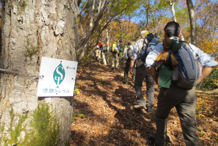

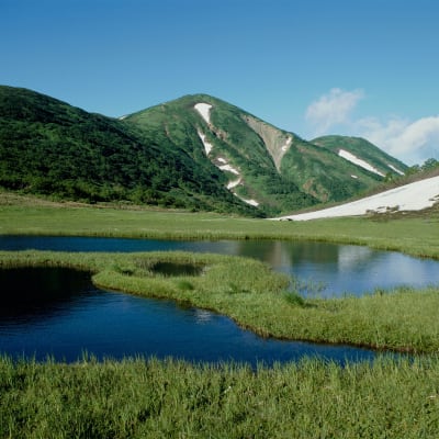
The Shin-etsu Trail runs for 80 kilometers along the Sekida mountain range on the border of Nagano and Niigata prefectures. The route was completed in 2008, and crosses 16 mountain passes, rising to an elevation of about 1,000 meters. The peaceful scenery along the trail is characterized by verdant, virgin beech forests, which turn brilliant colors in autumn. The packed earth trail is easy to follow, and can be enjoyed as a circular day trip course, or done in sections, staying in overnight accommodations. Along the way you can immerse yourself in the culture of satoyama, Japan’s unique mountainous farming communities.

Detail
Duration 1day / 5hours
Highest Point 1,135m (Mt. Hakama)
Elevation Gain 985m
Horizontal Distance 9km
* Duration is an estimate and may vary depending on route and pace.
Reference: A circular course starting from Numano-hara marshland to Akaike, Mt. Hakama and Manzaka Pass.
Access
From Tokyo Station, Take a 100 minutes from JR Tokyo Station to JR Iiyama Station by Shinkansen. JR Iiyama Station, take a taxi for about 30 minutes to the trailhead on Mt. Madarao. Or from JR Morimiyanohara Station, which is about an hour train ride from JR Iiyama Station, it is also about 30 minutes by taxi to the Matsunoyama trailhead on Mt. Amamizu.
Links
Shin-etsu trail (Official Web Site)