


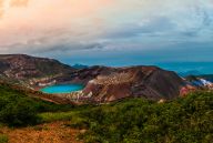

Partners Information: The Maruyama River is the main river in northern Hyogo Prefecture, running 68 kilometres through Toyooka, cutting through mountains and emptying into the Sea of Japan.
In 2012, the Lower Maruyama River and the surrounding rice paddies became registered with the Ramsar Convention, an international treaty for the conservation and sustainable use of wetlands. The Maruyama River services as an important part of Toyooka’s nature, wildlife, and tourism. It feeds into the Otani River, which is the canal that runs through Kinosaki Onsen. The canal provides a picturesque atmosphere as guests stroll through town in their yukata.
Visitors to Kinosaki Onsen can easily bike north along the Maruyama River and reach Kehi Beach and the Tsuiyama Fishing Port before heading up the hill to Marine World.
They can also bike in the other direction towards the Hachigoro Wetlands and Genbudo Caves. They consist of 5 caves made of columnar joints that formed over 1.6 million years ago after the magma from a volcanic eruption cooled, contracted, and formed vertical cracks. These curvaceous columns have a distinctive polygonal shape and a honeycomb pattern.
The river also helps maintain the lives of the wild Oriental White Storks, the symbolic bird of Toyooka City. Since they feed on many small animals, their ideal habitat is rice paddies and rivers.
With the help of the Lower Maruyama River and surrounding rice paddies, work has been done to preserve and create this type of optimal wetland environment.