


STORY 6 Japanese hikes to take your breath away
Find out for yourself why trekking in Japan has become so popular
Japan has enjoyed a hiking boom over the years as visitors venture beyond the major cities to explore the 75% of the country that’s mountainous and often unspoilt. There’s no shortage of awe-inspiring treks around volcanic hills, through exotic forests and past traditional villages surrounded by green meadows and cascading rice terraces.
We’ve chosen six stunning hikes for your next holiday in Japan that are suitable for most fitness levels, but might just lift you out of your comfort zone for a few hours. Once you’ve got your breath back, you’ll be very glad you made the effort.
1. Mt Asahidake Circuit Hike
Daisetsuzan National Park, Hokkaido Prefecture
Difficulty: Medium
Distance: 10.5km
Highest point: 2,291m
Elevation gain: 690m
Duration: Allow 1 day / 6 hours for the round trip

‘Daisetsuzan’ means ‘great snowy mountain’ but it is also referred to as ‘Kamui Mintara’ by the indigenous Ainu people, meaning ‘playground of the gods’. Here, you’ll find more than 16 peaks over 2,000m high amid the thick alpine grasslands and hot spring villages in these spectacular ranges on Japan’s northernmost prefecture.
The summer hiking season is from late June to September and a visit from late August to mid-September will allow you to see the park in stunning autumn colours. If hiking between September to June, plan your hike with winter mountaineering in mind.
There are numerous trails for every fitness level, but a walk up Mt Asahidake, Hokkaido’s highest peak is a must. Take a 10-minute ropeway from Asahidake Onsen to start at Sugatami Station, making your way past scenic ponds, unique rock formations and be rewarded with sweeping views of the Daisetsuzan mountain range towards the summit. Finish your hike with a well-deserved soak at Asahidake Onsen.
Look out for: The entire Daisetsuzan area is a habitat for brown bears. Make noise as you hike so as not to catch them by surprise and never throw away rubbish or leftover food in the mountains. You might also see chipmunks and Northern pikas - small, mountain-dwelling mammals called ‘crying rabbits’ in Japanese due to their ear-piercing alarm call.
Getting there: Asahikawa Airport in Hokkaido is a 100-minute flight from Tokyo. As public transport is limited, it’s best to rent a car, but there are buses that’ll get you into the park. Or take a JR Limited Express train from Sapporo to Asahikawa and then a bus bound for Asahidake.
2. Mt Shirakami 2-day Hike
Shirakami Sanchi, Akita and Aomori Prefectures
Difficulty: Medium
Distance: 12.3km
Highest point: 1,235m (Mt Shirakami)
Elevation gain: 1,217m
Duration: Around 14 hours over two days
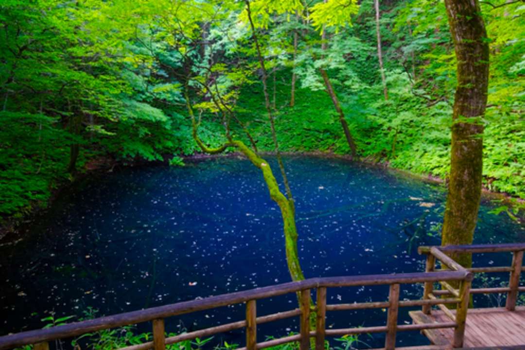
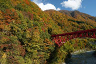
Shirakami Sanchi, a UNESCO World Natural Heritage site, borders the northern prefectures of Aomori and Akita. It is a remote and largely untouched Japanese wilderness and contains the last remaining virgin forest of Siebold’s beech, the tree that once flourished across most of the country’s north. From late September to early November you’ll experience the full majesty of the breathtaking ochre leaves of the Mongolian oak and Japanese sumac, and the dazzling gold of the beech trees themselves.
This two-day trek involves some serious climbing, but the rewards make it well worth the effort. On the first day, you hike the Okuzure Route, passing by the impossibly blue waters of Aoike Pond and climbing for an hour before it levels off for stunning views across the bewitching tapestry of 33 lakes and marshes that make up Lake Juniko. Retrace your steps for the return hike and stay overnight in the Shirakamidake sancho hinan goya (an unmanned mountain shelter).
The next morning, take the Gono Line to Shirakami Tozan-guchi Station before ascending for over four hours to the grassy top of Mt Shirakami to gaze out across the dark blue Sea of Japan and pretend you’re not just catching your breath!
Look out for: Golden eagles, black woodpeckers, Japanese macaques and Asian black bears. Carry a bear bell when walking and make noise to avoid bear encounters.
Getting there: Four hours by train from Tokyo along the Akita Shinkansen to Akita Station, and then two more hours to Juniko and a short bus ride to Okujuniko Chushajo bus stop.
3. Kawazu Seven Waterfalls Walk
Izu Peninsula, Shizuoka Prefecture
Difficulty: Easy
Distance: 850m
Duration: The waterfall trail only takes about an hour
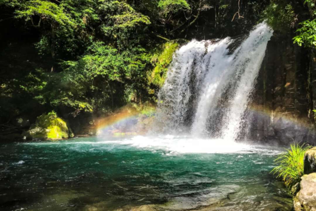
A popular winter/early spring holiday destination for the wondrous deep pink early-blossoming Kawazu cherry blossoms that reach full bloom in early February every year, the town of Kawazu in Shizuoka Prefecture offers delights for hiking visitors at any time of year.
The seven waterfalls flowing from the pure waters of the Kawazu River stretch along an 850-metre walking trail through the forest in the mountains above Kawazu. Finish your hike with a refreshing dip in the swimming hole beside Odaru, the largest of the seven falls. After your hike, stay overnight at one of 7 different onsen areas, including onsen with views of the mountains or the sea. In the summer, head to Imaihama or Kawazu Beach to enjoy various water sports such as scuba diving and canoeing.
Look out for: Statues depicting the tale of The Izu Dancer, a short story by Nobel Prize winner Kawabata Yasunari and a 46-metre-long suspension bridge.
Getting there: From Tokyo Station, take the Odoriko or Super View Odoriko to Kawazu Station in 2.5 hours. From there, a 35-minute bus ride will take you from Kawazu Station to Mizutare bus stop and the start of the hike.
4. Mt Daisen Hike
Daisen-Oki National Park, Tottori Prefecture
Difficulty: Medium
Distance: 5.6km
Highest point: 1,709m (Mt Daisen)
Elevation gain: 957m
Duration: 1 day / 5.5 hours
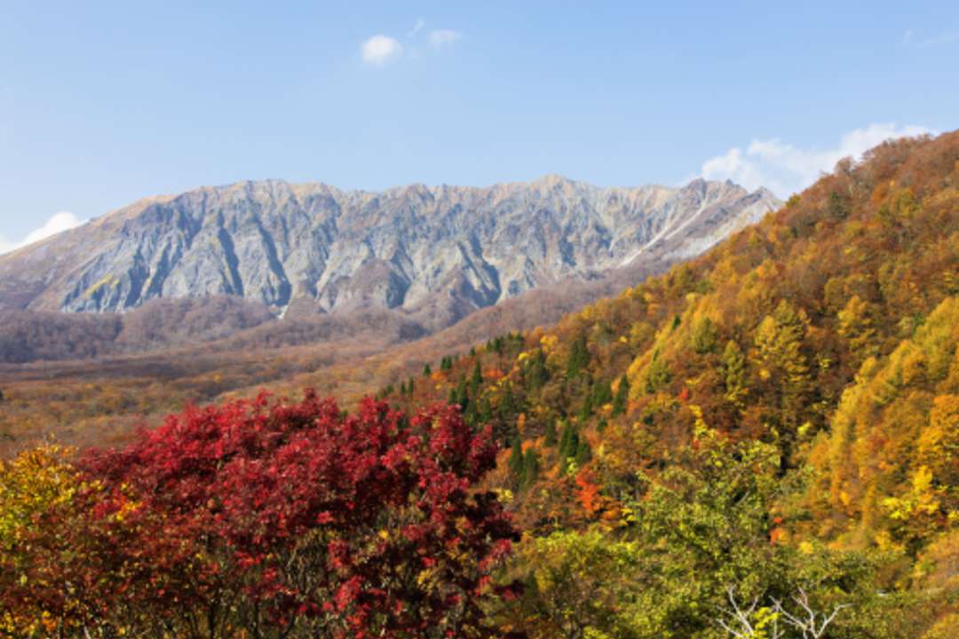
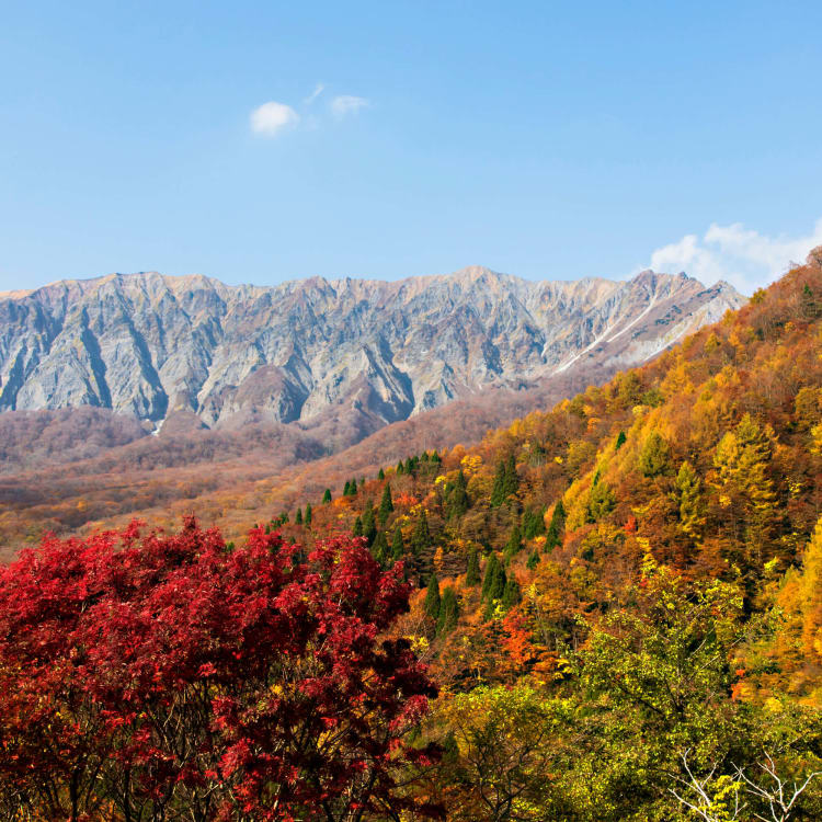
With its jagged coastline, dense forest slopes and ancient temples, Daisen-Oki National Park attracts visitors all year round. Dominated by the striking sacred mountain of Mt Daisen, it contains a number of treks, and this one, which starts at the Bakuroza car park, follows the Natsuyama Trail to Misen Peak, passing Daisenji Temple which is near the trail head. The trail is steep, but even beginners can take on the hike in summer.
Try forest bathing in one of the largest beech forests in western Japan. Emerald green from spring through summer and golden in autumn, it will rejuvenate your body and mind.
The view from the summit is well worth the effort, though it can get very windy. Don’t forget to pick up your commemorative climbing badge from the shop in the summit hut in summer.
Look out for: The sweeping vista across the dwarf Japanese yew trees and sweeping 360-degree views of the Sea of Japan, nearby Oki Islands and the Chugoku mountain range.
Getting there: Fly from Tokyo to Yonago in 1 hour and 15 minutes. It’s a three-hour train journey from Osaka. From Yonago Station, it’s about an hour by bus or 30-minutes by taxi.
5. Kankakei Gorge Hike
Setonaikai National Park, Shodoshima, Kagawa Prefecture
Difficulty: Easy
Distance: Around 2km return
Duration: Around 2 hours
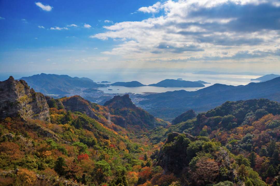
One of the most dramatic and beautiful gorges in Japan, Kankakei is in the mountainous centre of the island of Shodoshima in Kagawa Prefecture. The stark cliffs plunge steeply toward the maple trees below, which erupt in an explosion of autumn colours through November, snowcaps in winter, vivid cherry blossoms in early spring and lush greenery in summer.
The hike is made up of two steep walks into the depths of the gorge, called the Omote (front: 2km) and Ura (rear: 1.8km) trails. Depending on your level of fitness, you could do the full hike or take the ropeway up to the summit and then hike down to the bottom. During your hike, take a break at the summit’s restaurant, the highest place in Shodoshima!
Look out for: Sekimon, a natural stone gate formation near Sekimondo Temple and Matsutake-iwa (Matsutake mushroom rock).
Getting there: Take the Shodoshima Ferry from Takamatsu Port to Tonosho Port (35 minutes). Take the Shodoshima Olive Bus from Tonosho Port bound for Sakate and alight at Kusakabe Port (30 minutes). Change for the Kankake Line bus and alight at Kountei (the last stop), which takes approximately 15 minutes.
6. Mt Takachiho-no-mine Hike
Kirishima-Kinkowan National Park, Miyazaki Prefecture
Difficulty: Medium
Distance: 5.5km
Highest point: 1,574m (Mt Takachiho-no-mine)
Duration: 3 hours 30 minutes

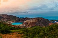
This slumbering line of more than 20 volcanos in Kirishima-Kinkowan National Park is home to crater lakes, hot springs, plateaus and natural vegetation, all formed by volcanic activity through time. Steeped in ancient myth and legend, Mt Takachiho-no-mine is said to be the place where Ninigi no Mikoto, the grandson of the Sun Goddess was sent to rule the earth and establish the lineage of Japanese emperors.
Starting and ending at Takachihogawara Visitor Center, this hike takes you to the ancient ruins of Kirishima Shrine, through a forested area and up a steep slope to the summit of Ohachi Crater. There you’ll be rewarded with views of Miike Crater Lake and the city of Miyakonojo. On a clear day you may be lucky enough to see the smoking peak of Mt Sakurajima in the distance. Ohachi is an active volcano and its crater is 500-metres across and 200-metres deep. The landscape is dotted with volcanic boulders that were ejected from Ohachi, dating back to the Meiji Period (1868-1912). Your hike culminates at the peak of Mt Takachiho-no-mine, where you can view the legendary three-pronged bronze spear, said to belong to Ninigi no Mikoto.
Look out for: The sunrise over the Hyuganada Sea, if you’re there early enough. The summit is popular on New Year’s Day morning to witness the first dawn of the year.
Getting there: Rent a car from Miyazaki Station, Kagoshima Station or Kagoshima Airport.